Humboldt State
University Department of Geology
Geology 350: Maps & Airphotos for
Geomorphology
The documents below are in gif, jpeg, or Adobe Acrobat PDF format.
You will need the Adobe Acrobat reader or browser plug-in to view the
PDF files. You can obtain it for free from this link: Acrobat
Reader.
Note: If you simply click on the links below, non-pdf
images will be displayed in your browser in greatly enlarged fashion.
To save the images at their nominal scales, click on the link, hold
the mouse button down (right button on a PC), and choose "Save this
link as..." in Netscape or "Save target as.." in MS Explorer. Then
use Photoshop, ArcView, or some similar image viewer to see the files
at their proper scales.
Some of the files have names longer than eight characters. If you
are running Windows 95 or earlier, you will need to download these
using the "save as" procedure above and rename the file to something
8 characters or shorter, not including the three-letter extension
(e.g. .jpg)
-
- Modoc Point and Swan Lake, OR
Maps
-
- These are 800 ppi scans in JPEG format of the Modoc Point and
Swan Lake 15' quadrangles .
Chittenden, CA (Lomerias Muertas)
Airphotos
-
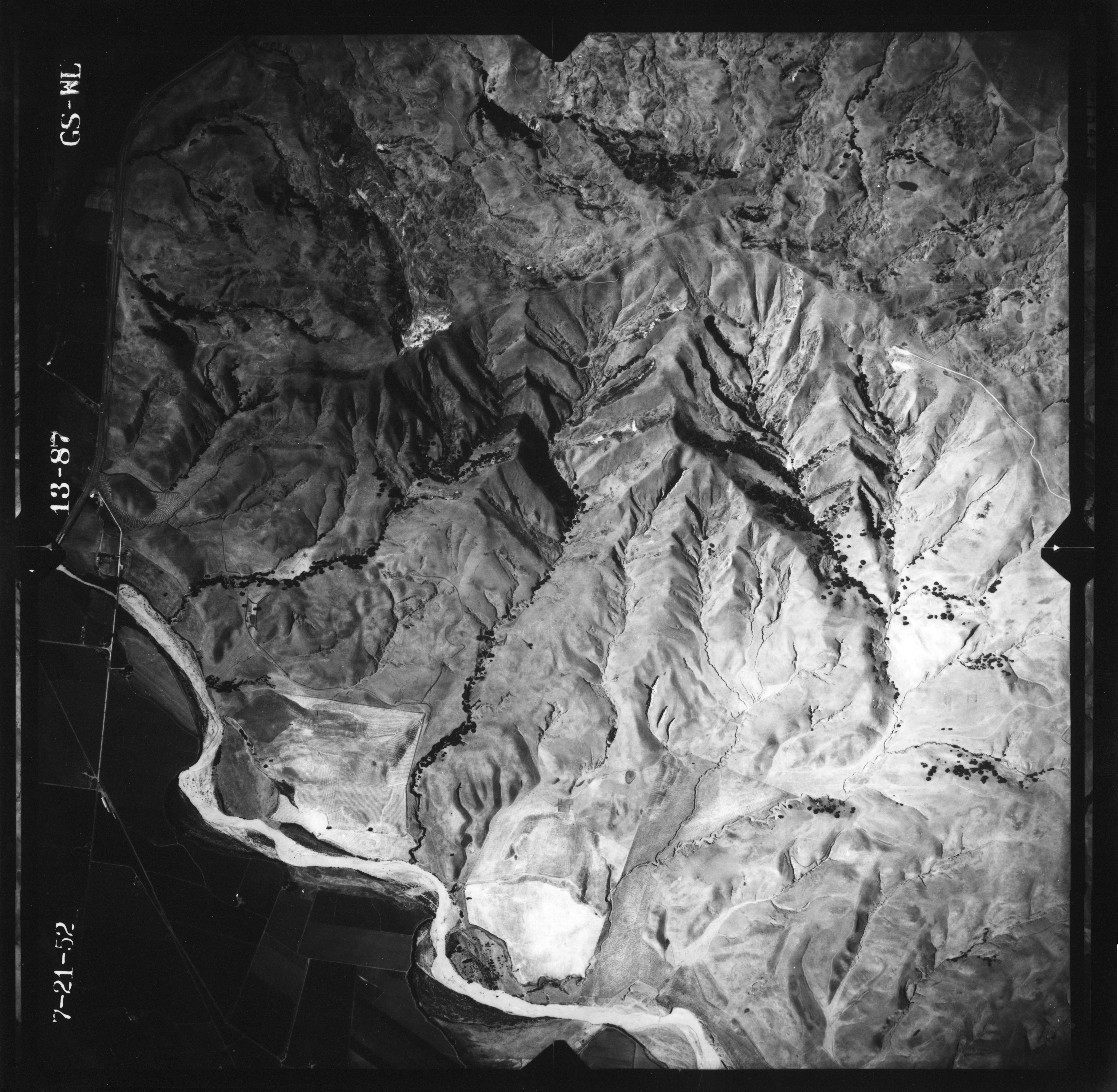
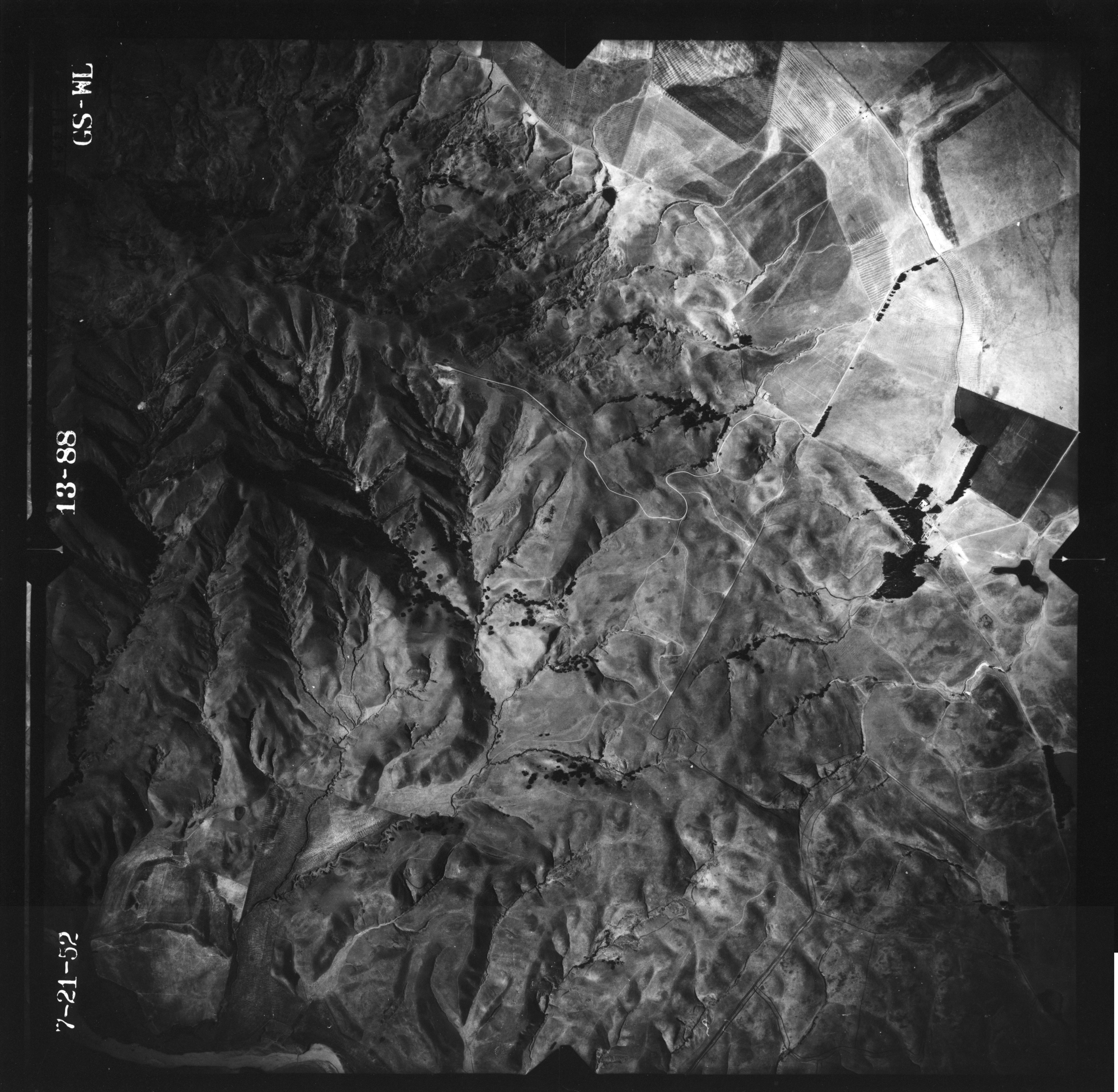
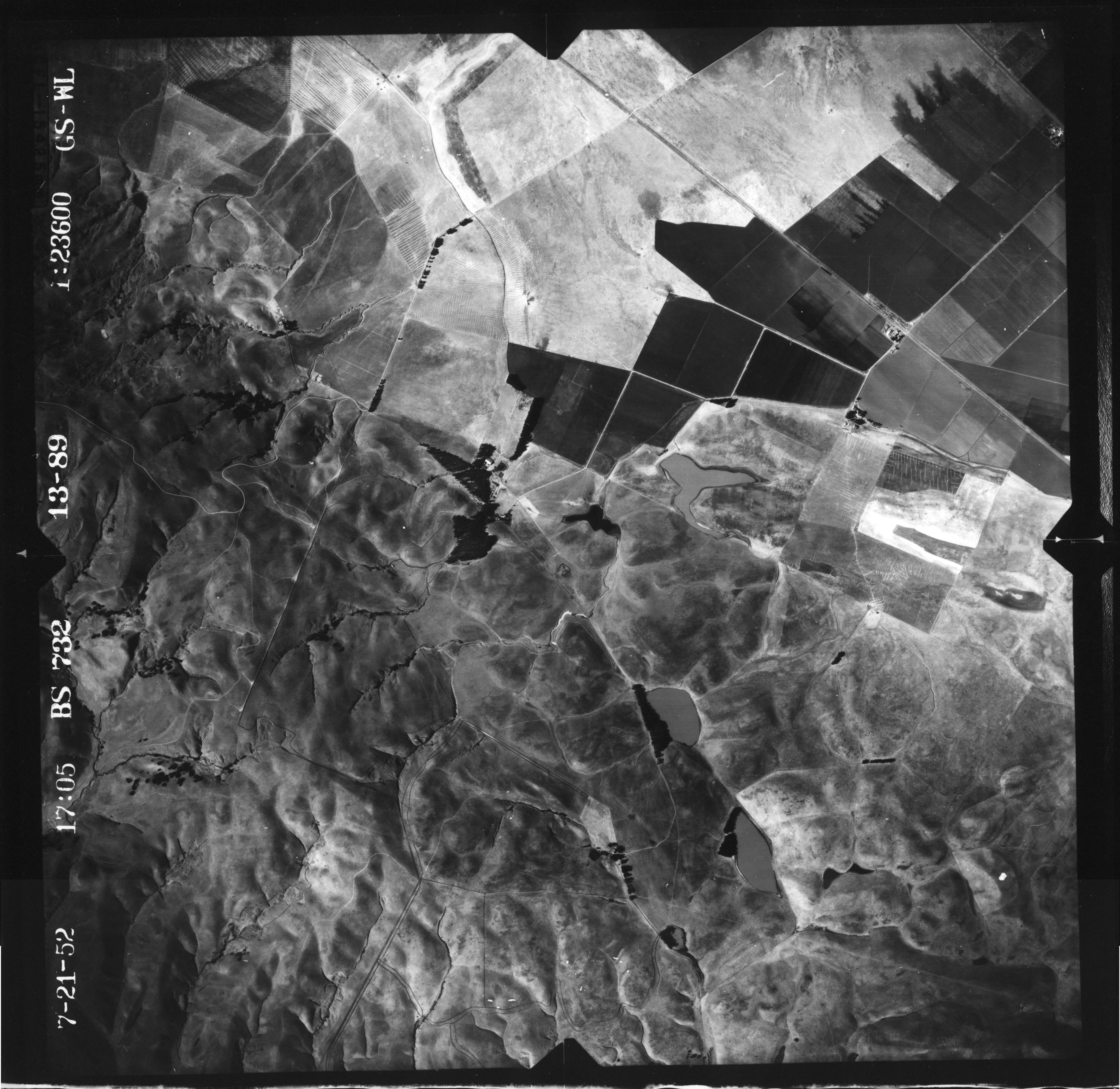
- These photos of the Lomerias Muertas in the SE quadrant of the
Chittenden 7.5' quadrangle were scanned at 600 pixels per inch
(ppi) into Adobe Photoshop 5.5 and saved as high quality jpeg
files. Because the flight lines run E-W instead of the
conventional N-S, the photos have been rotated so that the headers
lie along their left margin.
-
- USGS 7-21-52 Photos, Series GS-WL, Scale 1:23600
B&W
-
-
- Chittenden, CA Map
-
- This is a 600 ppi scan in TIFF format of the USGS Chittenden
7.5' quadrangle, saved as a gzip file.
-
-
-
- Chittenden, CA DEMs
-
- The Lomerias Muertas lie in the SW quadrant of the Chittenden,
CA 7.5' quadrangle. A 10-m DEM of the quadrangle is available
below. Save this to a file; it won't open in any meaningful way in
a browser.
-
- 10
m resolution DEM of Chittenden quad (chittenden.dem)
10270K
-
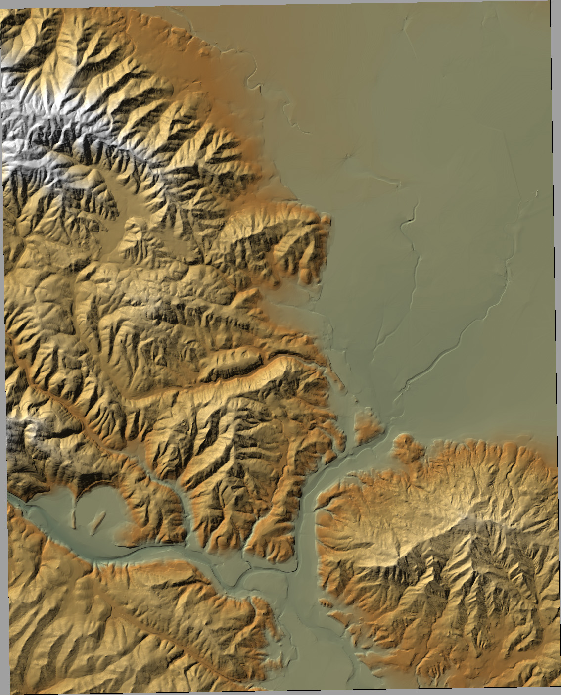
- The 10-m Chittenden DEM is rendered below as a shaded relief
image. The Lomerias Muertas lie in the lower-right corner of the
image.
10
m resolution DEM of Chittenden quad as an image file
(chittenden_dem.jpg) 508K
- Lomerias Muertas Landslide Oblique
Airphotos
-
- These are oblique airphotos of the large earthflow on the N
flank of Lomerias Muertas, taken from California Division of Minea
Bulletin 158 (1952).
-
- Lomerias
Muertas landslide oblique photos
(Lomerias_slide_obliques.pdf) 3.6 Mb
-
Lomerias Muertas Geologic
Map
-
- This is a 600 ppi scan in JPEG format of Lomerias Muertas and
vicinity from the Santa Cruz Sheet of the Geologic Map of
California, 1959 ed. Scale is 1:250,000 when printed from
Photoshop. It will display on your browser screen greatly
enlarged.
-
- Lomerias
Muertas geologic map (lomerias_muertas_geol.jpg)
1286K
-
-
-
Andre Lehre
Last updated: 5 October 2005