


Breadcrumb
Projects
This page highlights several ongoing projects relating to sea level rise in the Humboldt Bay region that the Cal Poly Humboldt Sea Level Rise Institute is aware of.
If you have a project that you would like to have linked to on this page, please email the Institute at: slri@humboldt.edu
FLKS Living With Water
The neighborhoods of Fields Landing and King Salmon (FLKS) frequently flood during high tides and storms. Oceans are rising and will continue to rise in the future, creating more frequent and extreme flooding. This project’s goal is to speak with and learn from the people who live with flooding in Fields Landing and King Salmon to create a plan for how to manage current and future flooding. The project is led by Humboldt County with support from Cal Poly Humboldt and planning consultant GHD, Inc. (formerly known as Gutteridge Haskins & Davey).
Humboldt Bay King Tide Photo Project
Humboldt Waterkeeper (2024-present)
Encouraging community members to document tidal flooding through photography.
Social Science Research to Advance Regional Coordination and Collaboration of Sea Level Rise Adaptation and Planning on Humboldt Bay
Kristen Orth-Gordinier (2015-2021)
Understanding the social, political, and economic dimensions relevant to SLR planning and adaptation on Humboldt Bay.
*** idk how to redo this link, its a SLRI project link
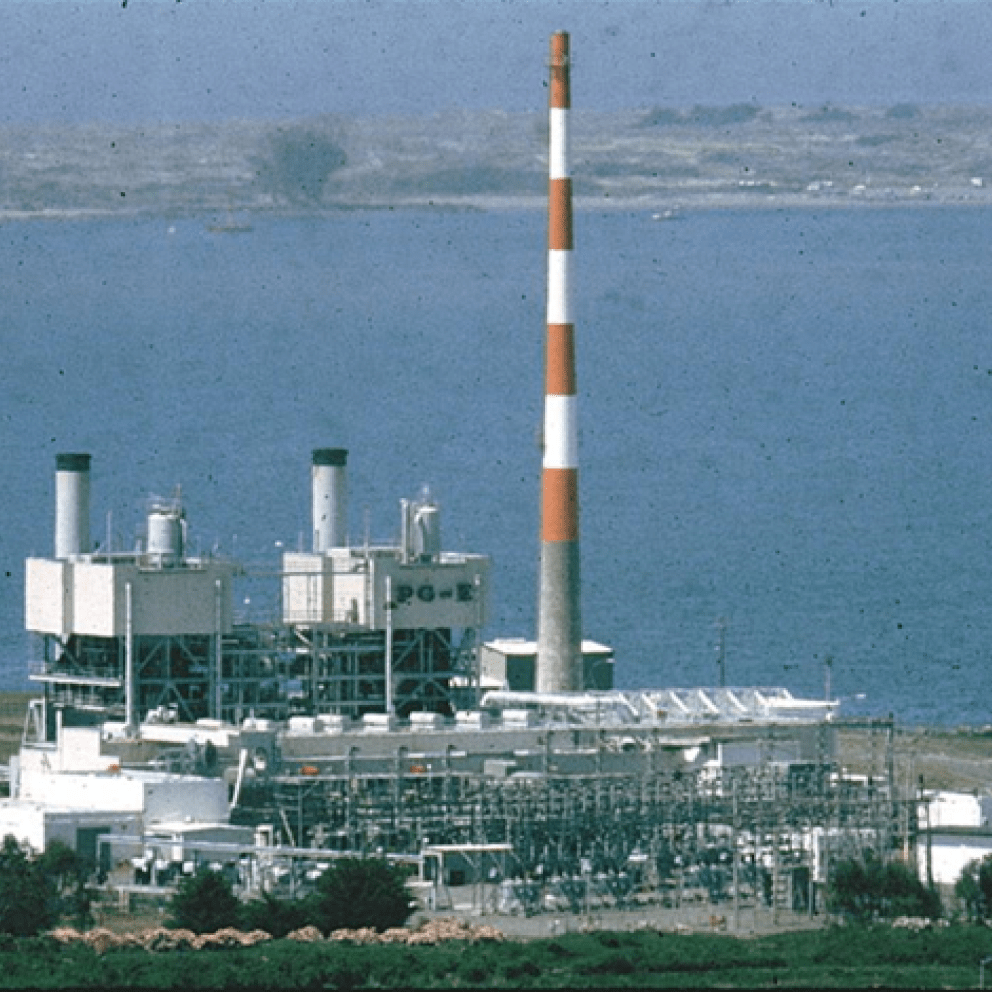
Frameworks for Managing the Known Vulnerability from Sea-Level Rise to Bluff Erosion and Exposure of Humboldt Bay Nuclear Power Plant’s Spent Nuclear Fuel Storage Site
Jennifer Marlow (2021-2022)
Researching long term risk mitigation surrounding the decommissioned Humboldt Bay Power Plant, which now stores spent nuclear fuel 115 feet away from the bay and only 44 feet above sea level. The site is currently highly vulnerable to coastal erosion, sea-level rise, storm surge, and tsunamis.
Wiyot Tribe Climate Change Resilience Planning and Climate Adaptation Plans
The Wiyot Tribe project will serve as a “Phase 1” approach to the Tribe’s Climate Change Adaptation Plan, with an initial focus on understanding flood risks. In Phase 1 the Tribe will begin the process of identifying cultural and natural resources that are vulnerable to sea-level rise and climate change.
Regional Projects
Highway 101 Corridor Sea Level Rise Assessment and Adaptation Planning
Caltrans, California Coastal Commission.
HSU Capstone Project to Inform the Creation of an Adaptation Plan: Caltrans 101 Stakeholder Outreach
Humboldt Bay Sea Level Rise Planning Feasibility Study
Humboldt County, California Coastal Commission (2020 – )
Humboldt Bay Symposium
California Sea Grant
Session videos and download links from the 2019 Humboldt Bay Symposium: Humboldt Bay Symposium 2019
Humboldt Bay Trail South Project, Living Shoreline Sea Level Rise Adaptation Strategy
Humboldt County, California Department of Transportation.
Humboldt Bay Trail South: Sea-Level Rise Vulnerability and Adaptation Report (June 2018)
Humboldt County Local Coastal Plan Updates
Humboldt County, Ongoing
Humboldt Coastal Resiliency Project
Friends of the Dunes, US Fish and Wildlife Service, State Coastal Conservancy, and the Ocean Protection Council, (2015-2021).
Friends of the Dunes Project Page
US Fish and Wildlife Service Project Page
Sea Level Rise Adaptation Plan for Eureka Slough Hydrographic Area, Humboldt Bay
Humboldt County, City of Eureka, California Department of Transportation, and Humboldt County Association of Governments, (2019-2020).
Humboldt County Project Workshop Materials (Report Pending): Humboldt County - Sea Level Rise
Sea Level Rise and the Coastal Storm Modeling System for Humboldt Bay and North Coast of California
USGS (2018 – 2022)
Ecosystem and community vulnerability to surface and subsurface flooding and salinity dynamics with sea level rise and adaptation strategies, Humboldt Bay, USGS, University of Wyoming, and EPA (2019-2022).
Other Groups
There are a number of other entities in Humboldt Bay with ongoing projects relating to sea level rise and coastal development. Listed below are the links to their websites where one can find more information about their work.
California Coastal Resiliency Network
California State Coastal Conservancy
Coastal Ecosystems Institute of Northern California
Humboldt Waterkeeper or email alerts@humboldtwaterkeeper.org to get involved